Geomap provide a full range of surveying services to suit the needs of the client:
Topographic, Photogrammetry & Hydrographic
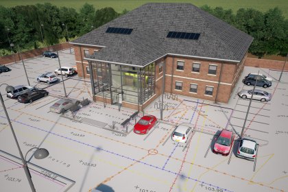
Geomap are a team of chartered surveyors who have been providing both 3D and 2D topographical surveys to a range of clients for both design and planning for over 15 years.
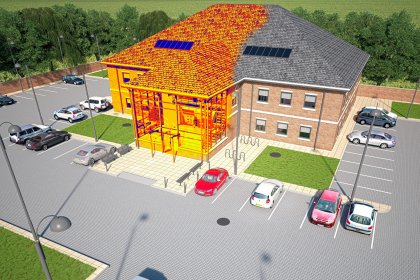
Building Surveys, Laser Scanning & 3D Modelling
Geomap offer a range of traditional and more advanced surveying solutions to capture data from existing buildings. This combined approach enables projects to be tailored to clients specific needs..
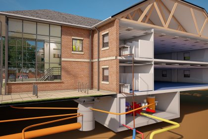
Utility, Drainage & GPR Surveys
Offering a range of techniques, Geomap provide clients with detailed surveys identifying subsurface utilities, supported with accurate and essential information.